Buzzards Bay Coastal Flooding
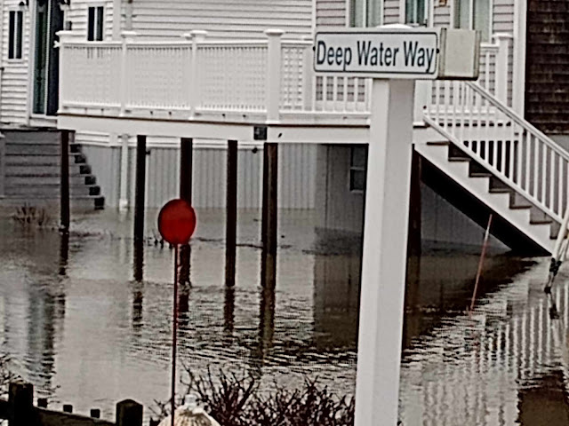
Urban planning is better with a sense of humor... This is Buttermilk Bay flooding Hideaway Village in Buzzards Bay. That's Buzzards Bay, village, not Buzzards Bay, body of water. Water can't flood water, I think. Buttermilk Bay flooding out Buzzards Bay is one of those Massachusetts things like "You're driving on Rte 1, Rte 93, Rte 3 and the Southeast Expressway, and it's the same road" or "Rte 6 and Rte 28 are the same road, until they're not" that confuse non-locals. Hideaway Village, which has Cohasset Narrows between it and Buzzards Bay (body of water), doesn't get really large waves. River runoff (Red Brook empties into Buttermilk Bay), storm surge and a strong South wind can shove the water inland somewhat. A series of storms has had this effect on the area all week, and I'm guessing that no one has a basement in Hideaway Village, It would take a bad hurricane to flatten houses in this area, but that hurricane would flatten a lot...