Tropical Storm Warning for SE Mass, Coastal Trouble Likely
Please note that nothing is set in stone, and forecasts can change rapidly day to day and even hour to hour. Any forecast models we show will be from close to when we publish this article. The author is not a meteorologist.
Hurricane Lee, presently far east of Florida, is making a northern turn and should pass close to Cape Cod over the weekend. Nothing I see anywhere is calling for a direct hit on Massachusetts, with the eye presently being forecast to hit Nova Scotia or possibly downeast Maine.
The storm will pass close to us no matter what, which is justicification enough to fire up the Hype Machine and trot out Kelly Anne.
Even if Lee misses us, it will have an impact, at least on the coast. Lee may be transitioning to extratropical, meaning that- good news- it will weaken, and -bad news- it will widen.
As a weakening hurricane widens, the winds that are normally wrapped tightly around the center begin to spread out some. This will provide tropical storm conditions that could and should touch Massachusetts, even if the eye stays way offshore.
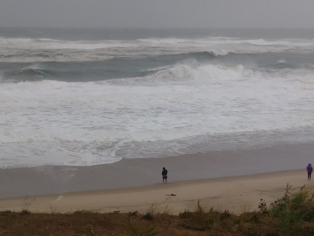
The heavy hitter will be surf. Lee will produce plenty of it, and not the 6-8 foot type we see with nor'easters. Several wave model sites have outer Cape Cod getting hit with 20-30 foot waves, and some sites even have places like Green Harbor looking at 10-13 footers just offshore.
A nor'easter, even a strong one, usually hits Green Hahbah with 6-8 foot waves. That could still happen, but the 10-13 footers can also still happen. For example, the map below is wave heights, not wind speed.
Those waves will be getting added to the top of a 3-6 foot storm surge. Cape Cod Bay looks to be the focus of the worst surge. A storm surge of 3 feet basically means that, were you standing on a beach at high tide and the highest wave just reaches your toes, the surge would then put your toes under 3 feet of water. With a hurricane, it also can add "then a 10 foot wave hits you."
That could lead to some coastal flooding, or at least beach erosion. If the storm moves west a touch and maintains strength, some of the damage could be to houses. There is a new moon high tide on Friday, although it is of the weaker summer variety.
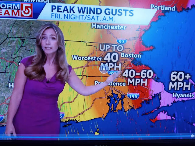
Coastal flooding to some degree is almost assured. We're a little less able to tell you what the winds and rains will be.
Cape Cod, especially the Outer Cape, could very easily see hurricane force winds. How far inland those winds push, and how much rain they bring, is a bit trckier than knowing there will be large surf. Somewhere like Attleboro, which got a ton of rain this week, woud have a few issues if Lee jiggled west some and we got 6 inches of rain.
The storm could even wobble east, and the effects on the mainland lessen. A betting man, looking at Massachusetts storm history, would wager on any approaching storm hooking east. This one may do so as well... or it may not.
We'll be back with updates as the storm gets closer, and at least one of us will be dumb enough to head out to a beach somewhere and record observations. Please stay tuned to your local news as the situation develops.


.jpg)

Comments
Post a Comment